
The map
This chapter as a clean, readable HTML page.
The “The map” chapter of the Operating Manual, reproduced as a real HTML page. Anything unclear? Open the original PDF of just this chapter (pages 160-169) (also pinned top-left). Hub: all chapters.
Introduction
Map – the most significant unit in Marvelmind Indoor GPS. It consists of submaps and forms a complete map of all the stationary devices you have. After you build and tune all the submaps and wake up the mobile beacon, you must click the Modem icon and freeze the map. It is the final stage of building the system. After you freeze the map, tracking will appear.
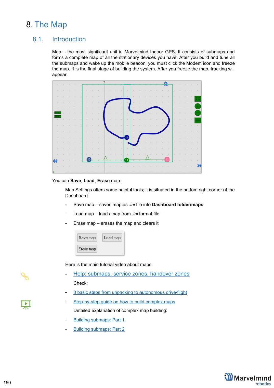
You can Save, Load, Erase map:
Map Settings offers some helpful tools; it is situated in the bottom right corner of the Dashboard:
Save map – saves map as .ini file into Dashboard folder/maps
Load map – loads map from .ini format file
Erase map – erases the map and clears it
Here is the main tutorial video about maps:
 Help: submaps, service zones, handover zones
Check:
8 basic steps from unpacking to autonomous drive/flight
 Step-by-step guide on how to build complex maps
Detailed explanation of complex map building:
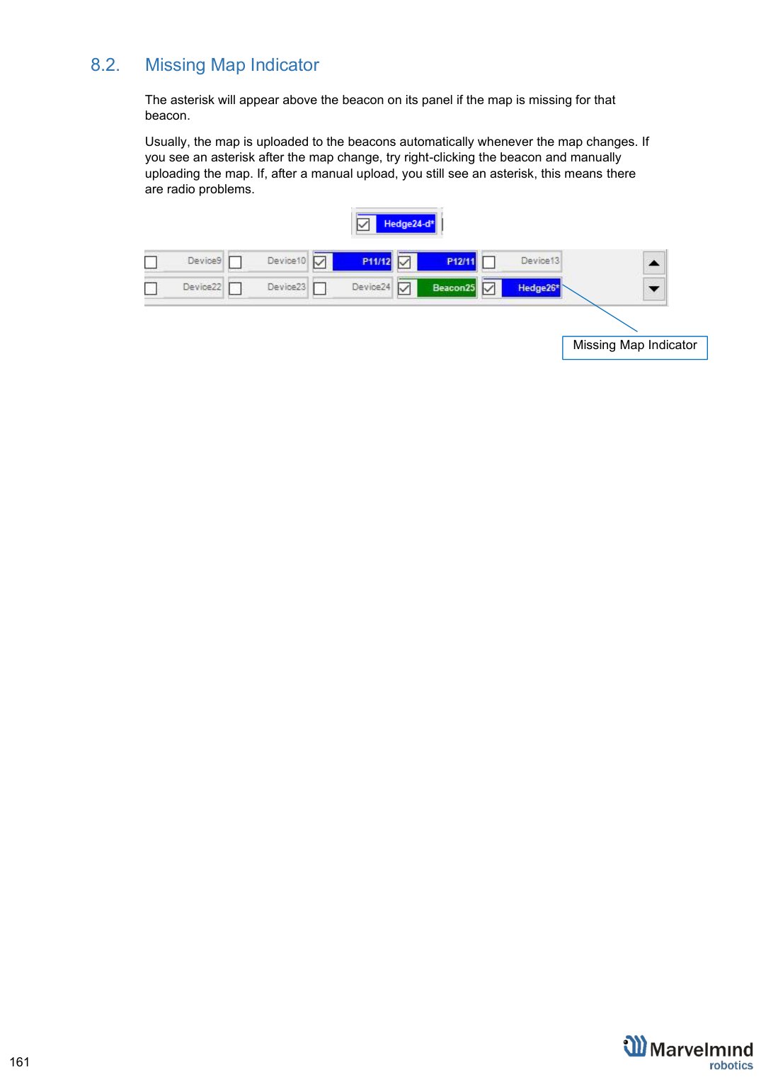
Missing Map Indicator
The asterisk will appear above the beacon on its panel if the map is missing for that beacon.
Usually, the map is uploaded to the beacons automatically whenever the map changes. If you see an asterisk after the map change, try right-clicking the beacon and manually uploading the map. If, after a manual upload, you still see an asterisk, this means there are radio problems.


Missing Map Indicator
Map Layers
The map consists of several layers. Each layer can be attached to the other.
- Service zones
- Floorplan – plan/scheme/picture of a floor where you placed beacons
- Beacons and Submaps
- Ether – map grid
The Submap
Submap is a logical unit. A part of the map. It unites beacons to work together in the system. The submap can contain 1 to 4 beacons. It can be 1D, 2D, and 3D.
For more information, check the links below:
Different types of submaps can be used together. Mix 1D, 2D, and 3D as you wish. For example, a map of the office floor may include a 1D submap of the corridor and 2D/3D submaps of the office rooms. All those submaps will form a large map with the required coverage.
Submaps can share beacons, allowing 3 beacons instead of 4. This is very helpful in the IA because we are limited to 8 ultrasonic frequencies.
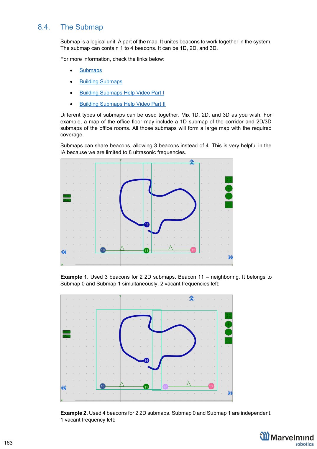
Example 1. Used 3 beacons for 2 2D submaps. Beacon 11 – neighboring. It belongs to Submap 0 and Submap 1 simultaneously. 2 vacant frequencies left:
Example 2. Used 4 beacons for 2 2D submaps. Submap 0 and Submap 1 are independent. 1 vacant frequency left:
Submaps’ Service Zones
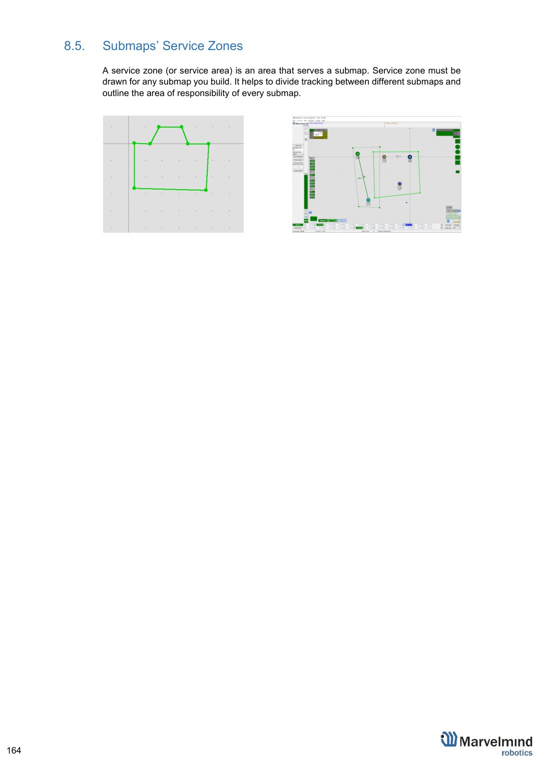
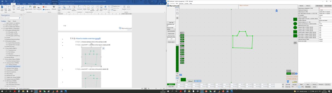
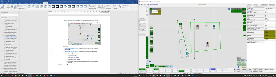 A service zone (or service area) is an area that serves a submap. Service zone must be drawn for any submap you build. It helps to divide tracking between different submaps and outline the area of responsibility of every submap.
Handover Zones
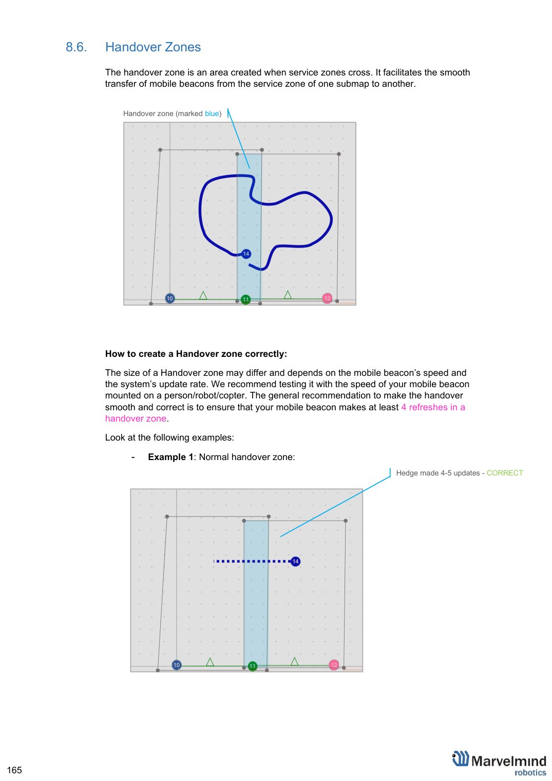
The handover zone is an area created when service zones cross. It facilitates the smooth transfer of mobile beacons from the service zone of one submap to another.
How to create a Handover zone correctly:
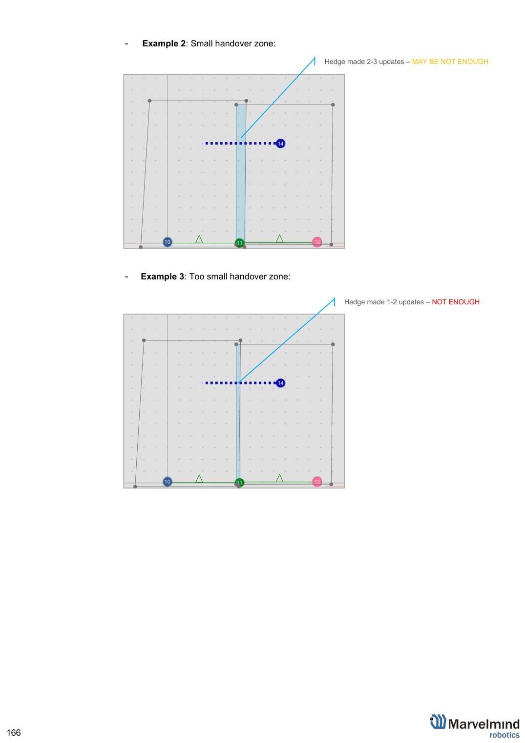
The size of a Handover zone may differ and depends on the mobile beacon’s speed and the system’s update rate. We recommend testing it with the speed of your mobile beacon mounted on a person/robot/copter. The general recommendation to make the handover smooth and correct is to ensure that your mobile beacon makes at least 4 refreshes in a handover zone.
Look at the following examples:
Example 1: Normal handover zone:
Hedge made 4-5 updates – CORRECT
\Example 2: Small handover zone:
Hedge made 2-3 updates – MAY BE NOT ENOUGH
Example 3: Too small handover zone:

Hedge made 1-2 updates – NOT ENOUGH
Example 4: No handover zone:
Service zones not cross – NO HANDOVER ZONE
CREATED, NO HANDOVER BETWEEN SUBMAPS
Beacons’ Ultrasonic Frequencies
The system may have different ultrasonic frequencies for beacons. This can be used for different aims and cases. In IA, it’s necessary to have stationary beacons of different frequencies.
 Please note that it is hardware-defined and cannot be just changed via settings in the Dashboard
Different frequencies can be used:
In IA, as a basic rule of Inverse Architecture’s functionality
In Multi-frequency NIA to increase update rate for multiple mobile beacons
To make it easy to distinguish, stationary beacons with different frequencies in the Dashboard are colored in different colors:
- 19 KHz beacon
- 22 KHz beacon
- 25 KHz beacon
- 28 KHz beacon
- 31 KHz beacon
- 34 KHz beacon
- 37 KHz beacon
- 45 KHz beacon
 Learn more about submaps, service zones, and handover zones here: How to create indoor navigation maps
Learn more about maps larger than 30x30m here: How to build maps larger than 30x30m
Learn more about building large indoor positioning systems here: How to build large indoor positioning systems
Here is the main tutorial video about maps:
 Help: submaps, service zones, handover zones
Check:
8 basic steps from unpacking to autonomous drive/flight
 Step-by-step guide on how to build complex maps
Detailed explanation of complex map building: