Industrial Geofencing: Safe & Dangerous Zone Management
Purpose of geofencing zones
Geofencing zones are virtual elements in the positioning systems that define safe and dangerous zones.
When the geofencing zone violation event occurs, the system does some actions. It can be, among others:
- Alerting the person of danger or the dispatcher
- Automatic stopping of vehicle or machine
- Recording of the event for follow-up, lessons learned, and future accident prevention
Geofencing zones can be static within the map or move along with mobile objects, for example, forklifts, AGVs, or cranes.
Typical use cases
Geofencing zones around dangerous objects:
- In many environments, there are dangerous static objects that people without authorization shouldn’t approach
- Preventing approaching too close open wells and stairs where people can fall
- Preventing robots or vehicles from driving into not allowed areas
Preventing people from climbing stairs:
- In many environments, personnel without authorization is not allowed to climb stairs due to safety
- Geofencing zone above a certain height will automatically alert the person via the feedback from the mobile beacon about the violation, and the record will be done in the system
Preventing people from standing under the crane load:
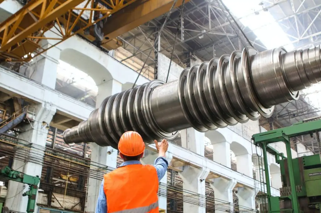
- This is an example of a mobile geofencing zone. It alerts people under the load, as well as crane operators about the dangerous situation
Preventing forklifts hitting AGVs:
- Forklift drivers do not see or hear AGVs, because they are low profile when don’t carry any load
- The geofencing additionally alerts the driver of the vicinity and the location of the AGV to prevent collision and the loss of equipment
Types of geofencing zones
Static geofencing zones
Static geofencing zones are defined on the map. They define either safe or dangerous zones, But the key characteristic of them that is effectively a property of the map – not mobile objects.
Static geofencing zones are supported by the system and do not require any special SW development or additional customization.
Mobile geofencing zones
Mobile geofencing zones are significantly more complex than static geofencing zones and typically require additional customization because each case is unique.
2D and 3D geofencing zones
Geofencing zones can be 2D and 3D. For example, if you want to prevent people from climbing stairs, you can set an upper limit for people’s mobile beacons. When their measured Z coordinate exceeds the limit, the person will be warned, and the record of the violation will be done in the system.
A similar approach can be used for drones – to prevent them from flying lower than allowed to the floor or closer than allowed to some objects.
What you get
Stream of data
Along with the location coordinates (XYZ for 3D or XY for 2D or X for 1) of your mobile beacon, you get many other pieces of information, for example:
- IMU raw data
- IMU + Ultrasound sensor fused coordinates
- Direction
- Telemetry of a different sort
- Geofencing zones violations
So, by interpreting the data received from your mobile beacon or modem, your external system can automatically make decisions to ring an alarm or even stop machines or engines and prevent accidents.
The protocols are open and readily available.
Records in log file
Effectively, everything that is streamed is also recorded in the log file. Thus, it is possible not only to react immediately when a geofencing zone violation occurs but also to use the log file for a post-event analysis and the lessons-learned.
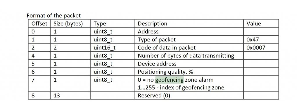
The Log File format is also described in the Protocols PDF.
External pin
In some cases, interpreting the protocol and extracting geofencing violation data is too complex for the external device, particularly when interfacing with simple devices. In this case, it is possible to use a pin, for example, on the Super-Beacon. The pin will be turned into the opposite position when the geofencing zone violation occurs.
Thus, it is possible to control the simplest devices, such as alarms or control engines, with just two wires: alarm and ground wires.
The functionality is enabled by a special SW license: MMSW0006: Dedicated pin for geofencing alarm.
Defining a static geofencing zone
- Supported up to 250 geofencing zones per map
- Each zone can be either safe or dangerous
- Define the time to be counted as a violation; for example, more than 1 second
- Define the distance to be counted as a violation; for example, more than 20 cm
- Geofencing will be violated if both Time & Distance are violated
- If you set, for example, 1 second time trigger and 20 cm distance trigger, but the violation was shorter than 1 second – a sporadic jump of location – it won’t be triggering the geofencing alarm; or if the violation were 1 minute but less than 20 cm, the geofencing zone violation wouldn’t be triggered either, because both criteria – time and distance – must be violated at the same time