How to design indoor positioning system?
Typical initial basic questions
Task description:
- What exactly shall be achieved in the project? Existing problems?
- Safety of people? Or productivity? Or both?
- Tracking of forklifts/vehicles for productivity? Cranes?
- Autonomous robots or drones or AGVs or boats?
- Drone landing to a moving vehicle? Parking a boat?
- Helping camera-based systems (positioning or AR/VR)?
Floorplan:
- We need your floorplan for the future full project, if available and for the proposed PoC
- It is important to mark on the floorplan by a yellow pen where the people/robots/drones/AGVs must be really tracked. Because, if just “everywhere” it could result in too many stationary beacons. For example, do you really want to track people in WCs? Or on the stairs?
- The floorplan doesn’t necessarily mean indoors. An area plan – whatever that gives a clear idea about the size of the area to cover, because it will directly affect on the complexity of the system, the number of stationary beacons required and even the proposed architecture
Photos/videos:
- Share as many photos as allowed and viable to share. Walls, ceiling – to see where the stationary beacons can placed
- Obstructions? The line of sight is the most important requirement for any precise indoor positioning systems
- Noise? Videos help to understand the level and type of noise on site and thus are valuable
- Very ideally, to just walk through the site with a camera/mobile phone camera like a typical user whom we need to track would walk – to simulate his/her typical activity so that we would see all the environment around the user and assess the complexity of the environment
Tracking in 3D or 2D or 1D:
- This clearly affects the number of beacons and, sometimes, confidence of tracking
- We support 3D tracking, 2D, 2D vertical (regular 2D, but instead of XY – XZ or YZ), 2.5D vertical (2D vertical & left or right, for example for aisles in warehouses), 1.5D (distance and direction), 1D (distance – tunnels)
- The video on the right starts with 1D tracking (corridor), then 3D tracking in the room; then – vertical 2D tracking on the stairs
How many mobiles:
- How many mobile objects will be tracked?
- What type?
- People?
- Vehicles?
- Cranes?
- Robots?
- Drones?
- A combination of them?
- The total number of mobile beacons & the required update rate per mobile beacon will directly affect on the proposed architecture. See more: NIA vs. IA vs. MF NIA – how to choose?
Location update rate per mobile:
- Location update rate per mobile object? It is important to understand the total number of mobile objects and the number of them simultaneously on site or simultaneously tracked
- Often, it is important to update locations and share with the mobile object, because it is using the data, but doesn’t necessarily update the modem/Dashboard, if it affects on the total performance of the system
- There are three architectures: IA, NIA and MF NIA. See more: https://marvelmind.com/pics/architectures_comparison.pdf
Geofencing zones:
- Static or mobile?
- Mobile geofencing zones – large vehicles or cranes, etc.
- How many and overall description of the requirements? – what shall trigger an alarm? Like, for example, “entering to the zone by 0.5m for more than 2 seconds” – something like that
See more about Geofencing for Industrial Applications.
Location+Direction:
- Magnetometers/compasses work indoors unreliably
- There is a solution – Paired Beacons
Inside or outside:
- Rain, dust, other environmental factors? – choose Industrial Super-Beacons or Industrial-RX with Omni
- Consider Omni-Microphones (outside) with Super-Beacon (inside or protected) – works for mobile beacons and IA
Working temperatures:
- Some beacons are designed for office-like environment (0..+40C). Others have a wide range (-40…+50C)
- Notice the performance is provide by design – not verified by thorough testing. Contact us if that is critical
- Use Industrial beacons for wider-ranger temperatures
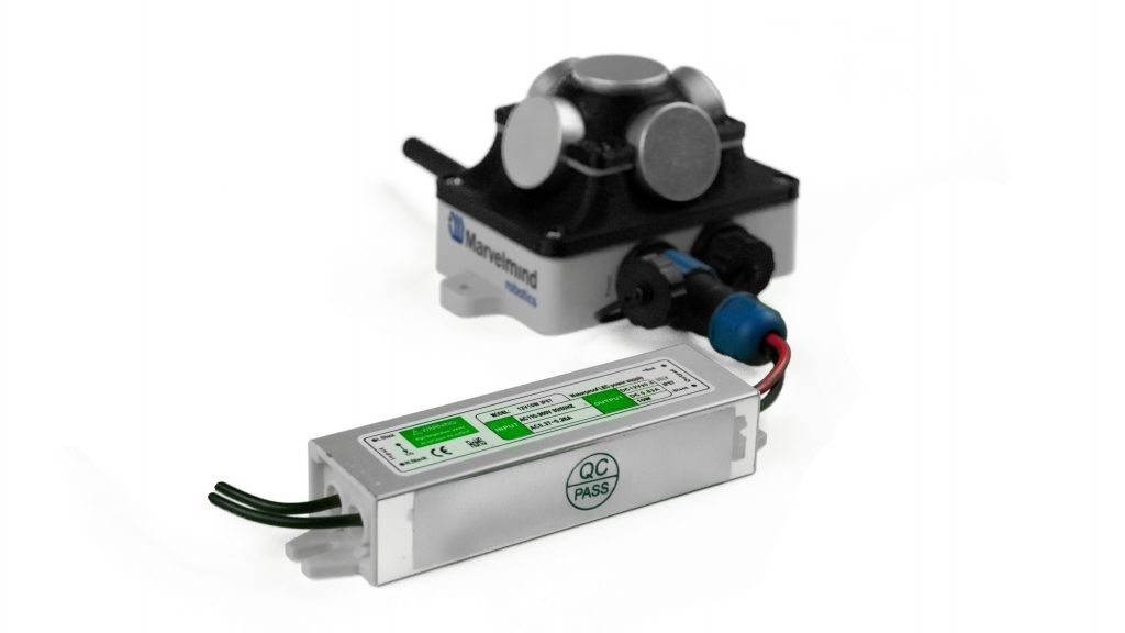
Power supply:
- Fixed power (~110/220V or +12V or +5V USB or Power over Ethernet, etc.) – recommended
- External battery?
– How often is the customer ready to recharge them? Charging takes 5-24h depending on the type of chargers and size of batteries
– Battery lifetime could be nearly any time and affect the size/cost of the external battery
– The battery lifetime is very much linked with the location update rate
– Also, may be linked with external temperatures, particularly with negative temperatures
Study more: Power supply options for beacons.